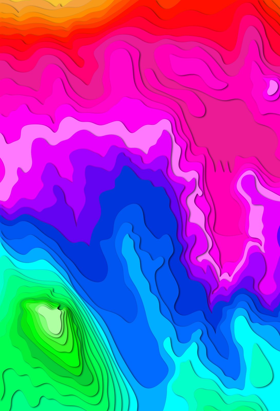
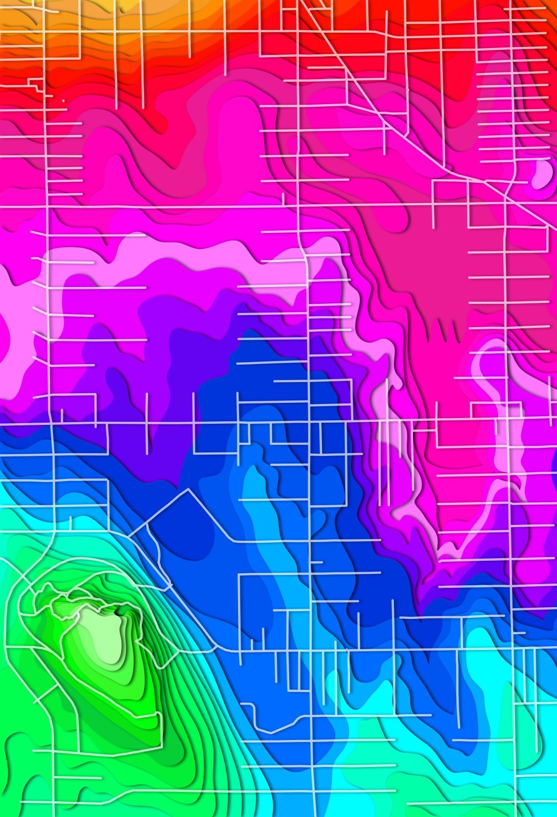
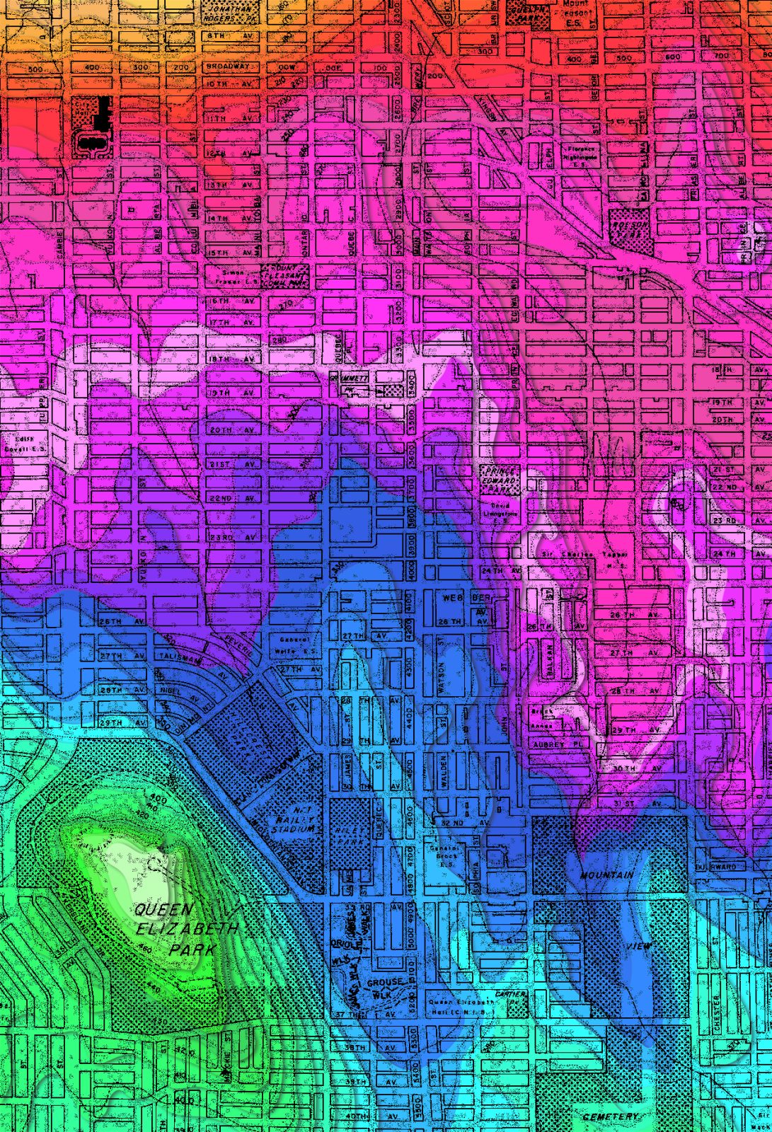
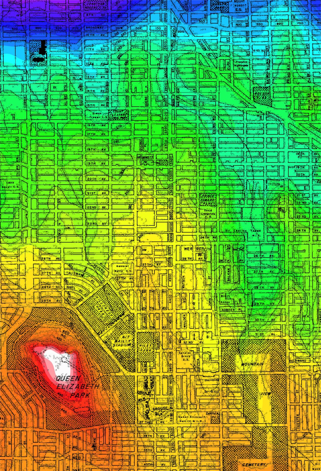
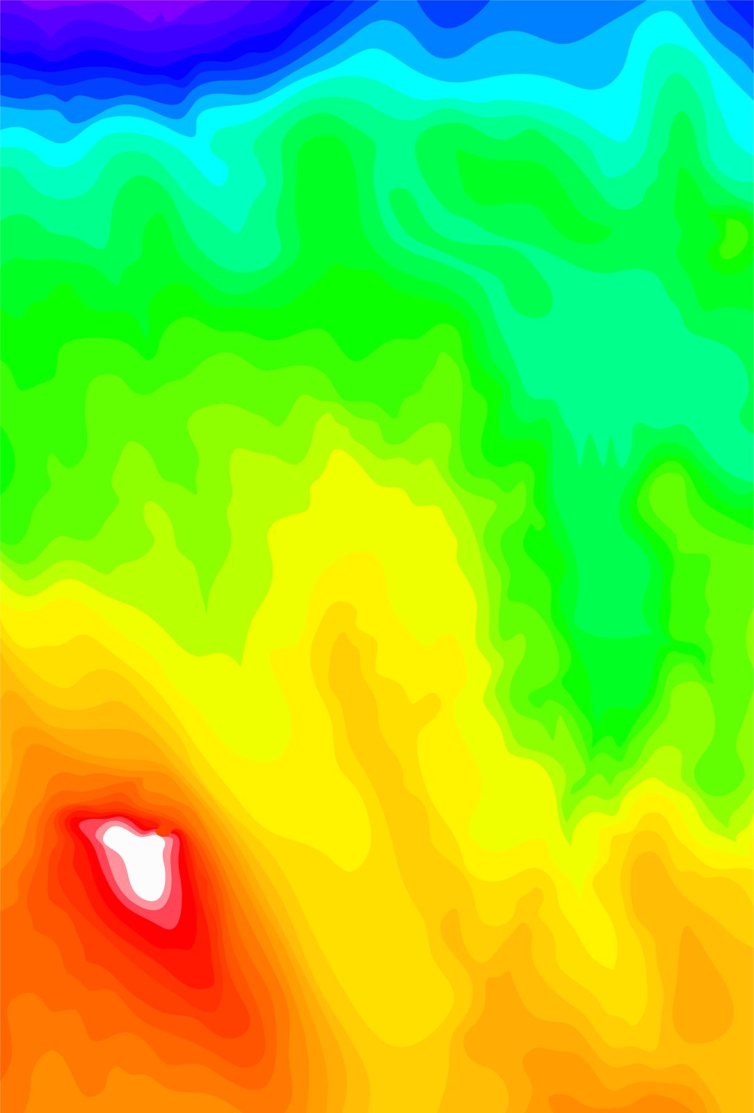
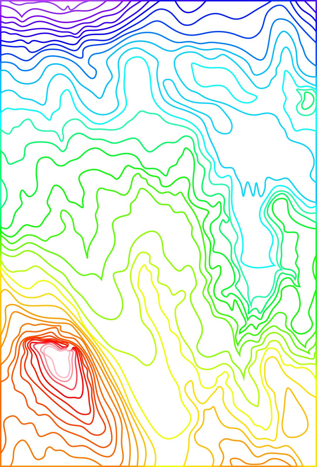
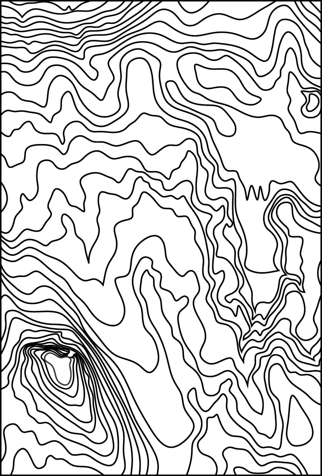
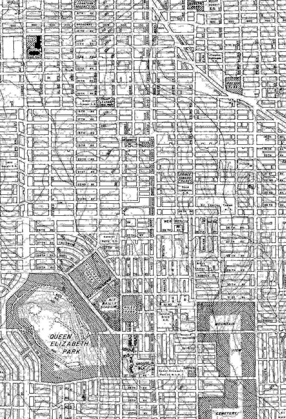
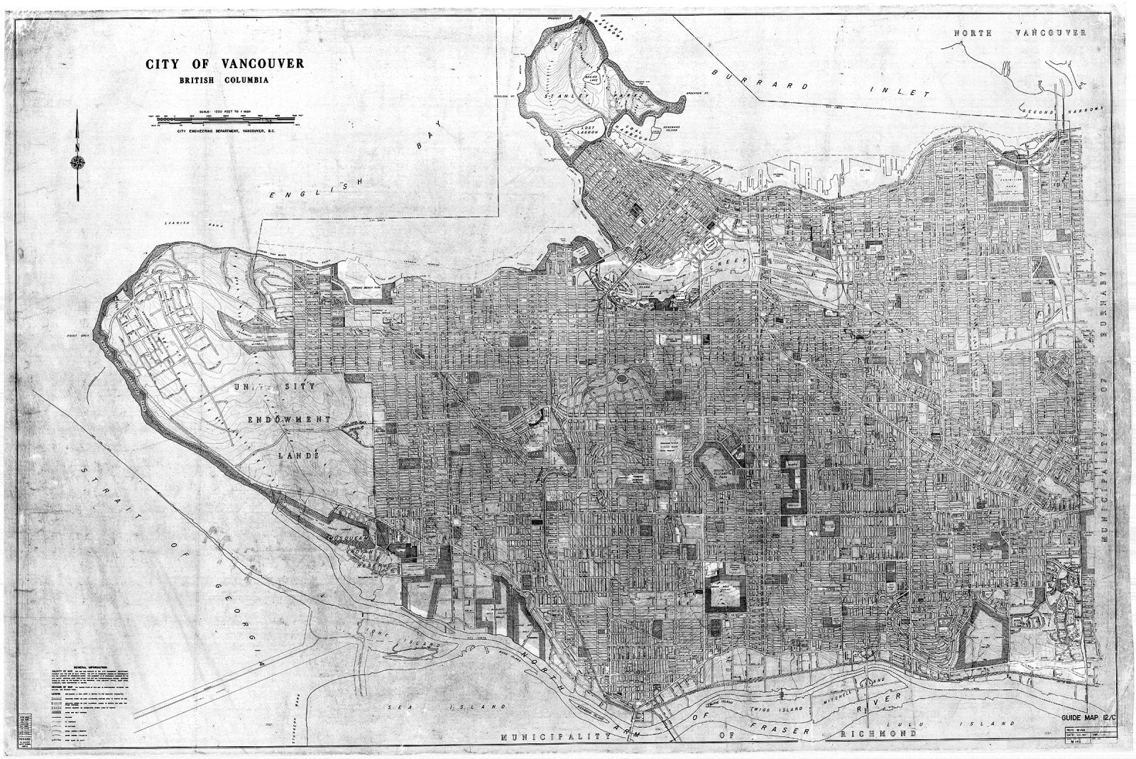
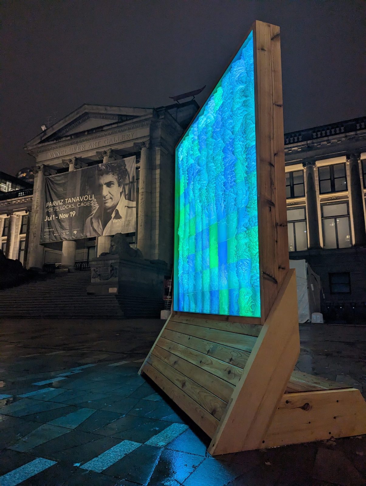
Popographic Mt. Pleasant is an art piece that merges art, topography, and locality. It offers a new perspective of the beautiful Mt. Pleasant neighborhood in Vancouver, through the use of a 1969 Vancouver Map to extract the topographic contour lines of the area. Starting from Main and Kingsway at 40 feet above sea level, the contour lines rise 36 times, at 10 feet each, to 500 feet at the peak of Queen Elizabeth Park. By rendering an elevation heat map, the lowest slope to the highest gradient is visualized, resulting in uniquely organic sections that come together to create a stunning visual. The hue of the map was shifted to create an original work of art, with the highest contour sections around Queen Elizabeth Park colored green, and the rest of Popographic following suit. A stylized street map overlayed on top anchors the abstract nature of the pop-colored contours and connects the viewer to the gradient of the artwork.